Author: Mohammad Jafari
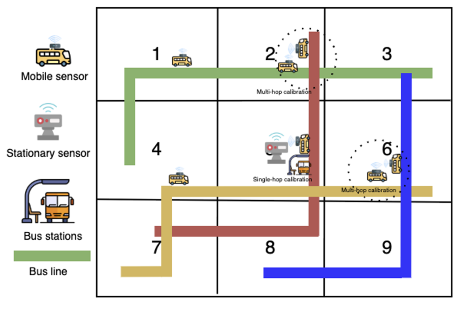
As part of Work Package 1 (WP1), we work on sensor network design optimization. Our main idea is to integrate sensor network design optimization with key performance indicators (KPIs) for low-car areas. In the first step, we select an environmental KPI, specifically air pollution. To improve the spatiotemporal coverage of the network and enhance model accuracy, we consider both stationary and mobile sensors. Public buses are chosen as the mobile sensing platform due to their reliability and extensive daily coverage. We then formulate mathematical models to determine optimal locations for stationary sensors and to select the most effective bus vehicles for mobile sensing tasks, with the objective of maximizing coverage and accuracy while respecting budgetary and calibration constraints.
Taking a citizen-centric perspective, we assign importance weights to each region based on population density and the vulnerability of residents to air pollution. Rotterdam is selected as our case study: we incorporate population data on a 500 m grid from the CBS dataset and obtain bus trajectory data from the KV6 dataset. Running the models across multiple scenarios indicates that extensive sensor coverage can be achieved on a limited budget, providing a practical framework for scalable, cost-effective urban air-quality monitoring.
We presented the results of our work at two international conferences in June 2025. The first presentation took place at the BIVEC-GIBET Transport Research Days in Luxembourg (June 5–6, 2025). The second presentation took place as part of EURO 2025 The European Conference on Operational Research in Leeds (June 22–25, 2025).
